The picture in September 2026
With just 1 dispatched call in September 2026, activity in UTM was one of Mississauga's quietest areas. That makes it the area's busiest month since tracking began in May 2026.
With this few calls, month-to-month changes are mostly statistical noise — see how to read neighbourhood statistics.
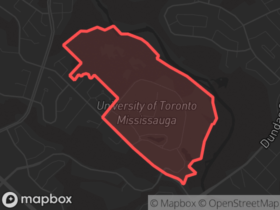
Neighbourhood attribution uses the official boundary polygon shown here; calls without reliable coordinates are excluded from neighbourhood totals.
Monthly history
Dispatched calls per month in UTM since May 2026. Hover a point for the exact count.
| Month | Calls | Priority |
|---|---|---|
| September 2026 | 1 | 0% |
| August 2026 | 0 | 0% |
| July 2026 | 0 | 0% |
| June 2026 | 0 | 0% |
| May 2026 | 0 | 0% |
Top call types
Too few calls for a category breakdown — categories with fewer than 3 calls aren't itemized (see methodology).
New to dispatch data? Read what the call types mean and how to read neighbourhood statistics.
Time of day
Too few calls in September 1 – 30, 2026 (1) for meaningful time-of-day patterns here — see the citywide picture instead.
Compared to its neighbours
| Neighbourhood | Calls | Per day | Priority |
|---|---|---|---|
| UTM | 1 | 0.0 | 0% |
| Erin Mills | 2 | 0.1 | 100% |
| Erindale | 0 | 0.0 | 0% |
Adjacent neighbourhoods, September 2026. "Per day" averages over all 30 days; "Priority" is the share of P1–P2 calls.
The app shows recent events on a map with filters, neighbourhood boundaries, and notification options for this area.