The picture in September 2026
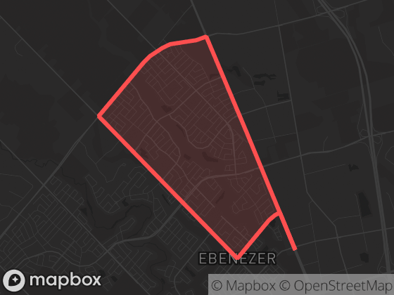
Ebenezer East recorded just 4 dispatched calls in September 2026, placing it 8 of 70 neighbourhoods and among the quietest areas of the city. By the area's own recent standards, that is a typical month.
With this few calls, month-to-month changes are mostly statistical noise — see how to read neighbourhood statistics.
Neighbourhood attribution uses the official boundary polygon shown here; calls without reliable coordinates are excluded from neighbourhood totals.
Monthly history
Dispatched calls per month in Ebenezer East since May 2026. Hover a point for the exact count.
| Month | Calls | Priority |
|---|---|---|
| September 2026 | 4 | 100% |
| August 2026 | 1 | 100% |
| July 2026 | 2 | 0% |
| June 2026 | 4 | 50% |
| May 2026 | 9 | 33% |
Top call types
Full breakdown — all 1 call categories
New to dispatch data? Read what the call types mean and how to read neighbourhood statistics.
Time of day
Too few calls in September 1 – 30, 2026 (4) for meaningful time-of-day patterns here — see the citywide picture instead.
Compared to its neighbours
| Neighbourhood | Calls | Per day | Priority |
|---|---|---|---|
| Ebenezer East | 4 | 0.1 | 100% |
| Highway 427 Industrial | 0 | 0.0 | 0% |
| Ebenezer West | 2 | 0.1 | 0% |
| Rivers Edge / Castlemore Crossing | 2 | 0.1 | 50% |
Adjacent neighbourhoods, September 2026. "Per day" averages over all 30 days; "Priority" is the share of P1–P2 calls.
The app shows recent events on a map with filters, neighbourhood boundaries, and notification options for this area.